Archive for the ‘Interactive Maps’ category
Top iPad app for parents, teachers and travelers [VIDEO]
August 26, 2011World Map Viewer with up-to-date Country Facts
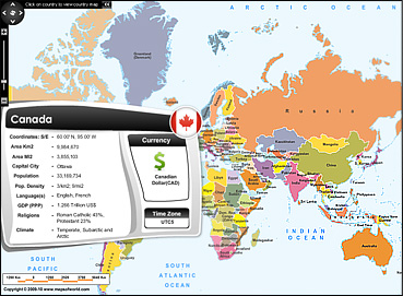
February 19, 2010Avid Internet users already know how fast web pages provide with relevant information. The best example of this can be the world map viewer application, which is just what you could wish for when looking for a quick snapshot of a particular country. World Map Viewer, an interactive map based application comes with a unique feature of providing vital information and statistics of countries of the world.
On mouse over a particular country you can view country details beginning from its coordinates, area, population, capital city, climate, language, religions followed and so on.

Also, on the right hand corner you can view the flag, Time Zone and the currency symbol of the country. You can even click the countries and browse through varied maps ranging from physical, outline, state, river, travel, etc.
Designed with this specific intent in mind, the world map viewer is going to be frequently used by most visitors on maps of world.
Human civilization repays Mother Earth with a dried up Aral Sea
February 3, 2010God created this Earth and human beings, making them the most intelligent of all the living organisms. Yet when they know their wrong doings, they make no attempt to save it, till the wrong is finally done and extra efforts are required to recover it….showing their concern for the mishap.
Aral Sea is one of the classic examples of such ruthless human action. Just to the east of the Caspian Sea, Aral Sea lies between the countries of Kazakhstan and Uzbekistan. At present the sea is just 10% of its original size and will disappear completely in the coming years. The Aral Sea tragedy started when the Soviet Union decided to divert the rivers flowing into the sea, to maximize cotton production. Fertilizer runoff, weapon testing residue left here by the Soviet Unions further polluted the sea, killing all life in it and changing the ecosystem surrounding the sea.
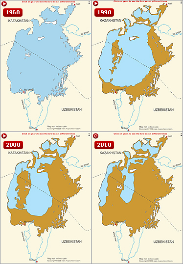
Aral Sea map paints a true picture of the shrinking sea. Beginning with the year 1960, Aral Sea was a healthy sea water body, undisturbed by human intervention.
As time progressed to 1990, the Aral Sea had shrunk a lot and by 2000 the entire water mismanagement effect was clearly seen. The 2010 map of Aral Sea shows that Aral is split into four different water bodies; where the lower three are connected by narrow channel.
A tiny part of the Aral Sea has been saved by Kazakhstan by building a huge barrier and with reintroduction of marine life, attempts are going on to revive whatever remains of the Aral Sea.
World Air Disaster Map
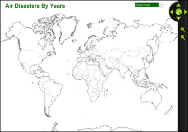
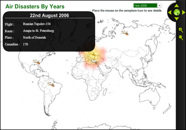
February 1, 2010In the first major air crash of 2010, an Ethiopian Airlines Boeing 737 crashed into the Mediterranean Sea killing all 89 people on board. The world has witnessed many such air crash disasters in the past. World Air Disaster map is an interactive map application, indicating all major air crashes of the world since 1998.
The mouse-over icon will show the airline, the route on which it was flying, causalities etc. In conclusion it is an informative map showing air disasters of the world.


